Information about the coordinate system required for your finished map, or about the individual datasets used to create your map, can be selected from pre-defined coordinate systems stored in MapLink Pro Studio. Alternatively, you can create and apply your own 'user-defined' coordinate systems. These may combine any of the supported projections and datums and can incorporate any false easting and northing, map rotation and/ or scaling required.
To view the coordinate systems supported in MapLink Pro Studio:
- Select Map | Output Coordinate System
- Click Select...
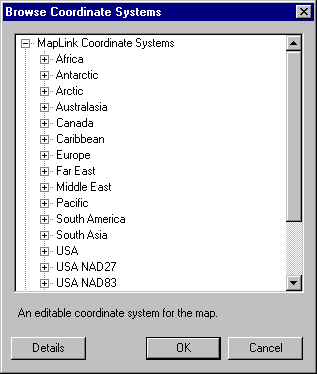
- Browse through the 'MapLink Pro Studio Coordinate System' section. To view the projection and datum details for one of the systems:
- Highlight it and click Details
- Click Cancel to the browser
- Click Cancel to return to the Map Properties section
- Click Cancel to return to the main screen
To view the projections and datums supported in MapLink Pro Studio:
- Select Map | Output Coordinate System
-
If the current coordinate system is not editable (see the information under the coordinate system name) you will need to temporarily apply an editable one to the map by doing the following:
- Click Select...
- At this point you may wish to make a note of the current system in case you want to re-apply it to the map later
- Select 'Default Map Coordinate System' and click OK to apply it to the map
- Click OK to return to the Coordinate System page
- Click Edit...
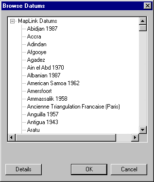
- To browse through the available datums, click the Datum tab and then click Datum Browser...
Click Cancel to return to the Coordinate System Properties section
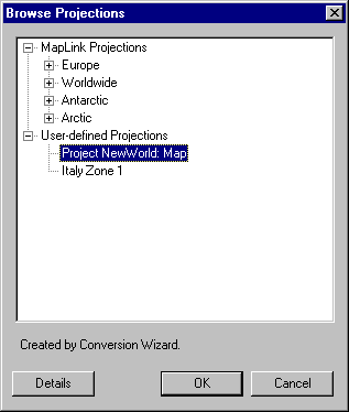
To browse through the available projections, click the Map Projection tab and then click Projection Browser...
Click Cancel to return to the Coordinate System Properties section
Copyright © 1998 to by Envitia Group PLC.