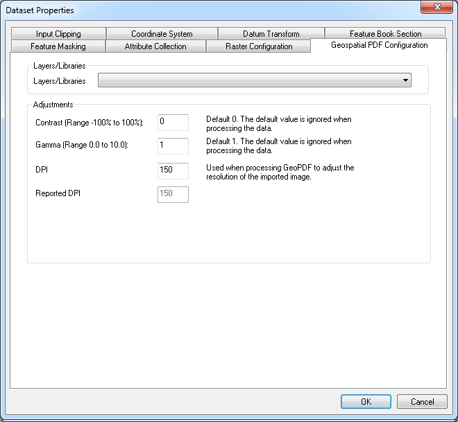
Geospatial PDF Configuration
The configuration panel allows you to select the a layer if one exists or to process all layers.
The default image resolution is set to 150 DPI. This may be changed, however if you select a DPI which is too large the conversion process may fail and produce a black image.
Copyright © 1998 to by Envitia Group PLC.