A polygon is topologically defined as consisting of a single outer ring, with zero or more inner rings (holes). Run-time performance may be affected if the map contains polygons with a large number of holes, because of the large number of native graphics calls needed to clip the holes out of the polygon.
MapLink Pro offers a special processing option called keyholing, to provide significant performance improvements in such cases. In keyholing, a polygon with any number of holes is converted into a polygon with no holes as shown in the simple case below.
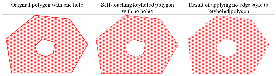
To achieve the correct visual effect, keyholed polygons should be rendered without edge styles. In many cases this is not a problem since separate features are often provided for related line and area features.
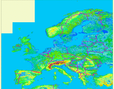
For example, the VMAP0 oceansea feature class treats the sea as a polygon, with a hole for each island. In the map of Europe shown below, the sea contains over 4,000 separate rings, of which the great majority are the holes that are needed for the islands. There is a separate coastl feature class that can be overlaid on the keyholed oceansea feature class, giving the desired rendering.
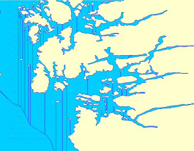
In this enlargement of the coast of Norway, the sea polygon has been given an edge style so that the result of applying keyholing can be seen.
 To apply keyholing to a data file
- Select the data file for which keyholing is to be applied
- From the Data menu, select Vector Configuration.
- Tick the Keyhole Polygons check box.
To apply keyholing to all files in a dataset
- Select the dataset for which keyholing is to be applied
- From the Dataset menu, select Vector Configuration.
- Tick the Keyhole Polygons check box.
Copyright © 1998 to by Envitia Group PLC.