The facility to apply coordinate system information at runtime is currently only available for vector maps.
To apply coordinate system information at runtime:
Select Map | Output Coordinate System
Click Select...
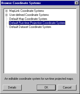
Select the 'Default Runtime Projection Coordinate System' and Click OK
- Click OK to return to the main screen
Once this is done, the Map Projection and Details pages for the Coordinate System cannot be edited. However, the Datum page is still editable and the selection made there is used as the reference datum. If it is known that a particular datum will be used at runtime, this should be selected since a datum transform can then be avoided, significantly improving performance. If the datum to be used at runtime is not known, then it is recommended that WGS-84 be used (the system will automatically default to this selection).
To edit the datum, please see Viewing/ Editing the current Coordinate System
known Limitations
Default Runtime Projection Coordinate System
Maps intended to be Runtime Projected must use the Default Runtime Projection Coordinate System. Although new coordinate systems can be created from the default, MapLink Pro Studio uses the ID of the Default Runtime Projection Coordinate System to set the map layer types, so if a different coordinate system is used the map's layers are not marked as Runtime Projection layers and hence the map cannot be reprojected at runtime.
Use of Datums other than WGS 84
- If an application requires a projection/coordinate system that is not based on WGS84, e.g. Spherical Earth (Mean Radius), the following is required:
- in the map each dataset needs to have the appropriate Input Coordinate System set for it, i.e. using the required Datum
- in the map the Default Runtime Projection Coordinate System needs to be edited to use the required Datum
- If an application requires to mix projection/coordinate systems based on different datums, e.g. WGS84, Spherical Earth (Mean Radius), etc. then a map must be created for each datum used, e.g. a map built with a WGS84 datum and a map built using the Spherical Earth (Mean Radius) datum and the TSLMapDataLayers must be switched before reprojecting.
Copyright © 1998 to by Envitia Group PLC.