This page is used to adjust the parameters used when exporting terrain or creating a Terrain Database.
A description of the options follows the picture.
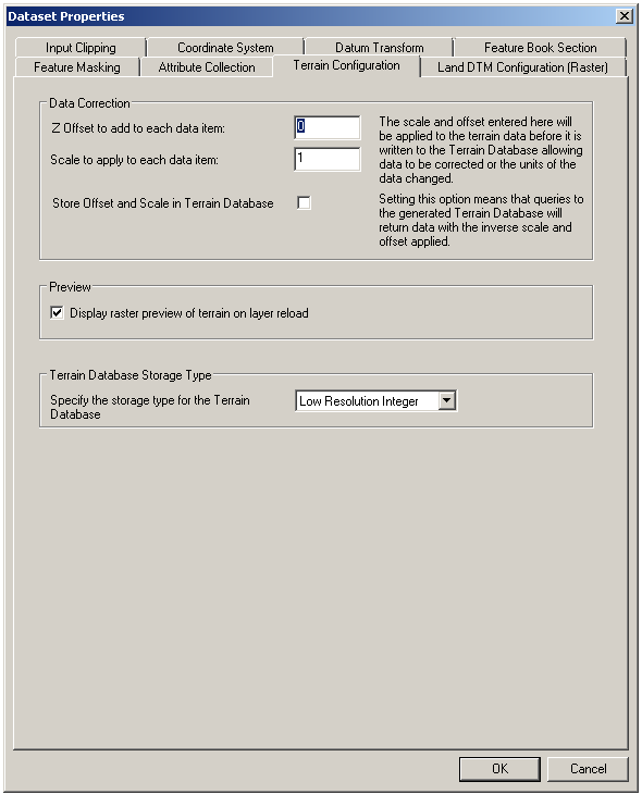
Data Correction
The settings contained in this section are used to adjust both the offset and scale of specific data to take account of data with different datums or scales (e.g. in feet). Values for scale and offset will be applied to the data before it is fused into terrain.
If the Store Offset and Scale in Terrain Database option is checked, any queries to the generated Terrain Database shall return the data with the inverse scale and offset applied, i.e. the scaling and offset shall be automatically removed.
Preview
When this option is selected the terrain is processed and displayed as a raster. Deselect this option to reduce memory use and to speed up the initial processing.
Terrain Database Storage Type
- Low Resolution Integer (default) – The data is stored as a 16 bit signed integer. This is sufficient resolution for DTED/DMED/DBDBV.
- High Resolution Integer – The data is stored as a 32 bit signed integer. This may be required if the scale added under ‘Data Correction’ is large.
- Floating point – The data is stored as a 64 bit IEEE floating point. This may be required for LIDAR data imported via the ArcGrid filter. This should be used if the input data is of better resolution then a meter so as to preserve the decimal point data.
Copyright © 1998 to by Envitia Group PLC.