The format configuration for the raster data is as follows:
Geolocated NITF images contain the position of each corner of the image in the input coordinate system. In some images these coordinates do not match the shape or orientation of the image as it appears in the source data. By default MapLink Pro Studio will warp and rotate the image as necessary in order to ensure it will be displayed in the correct position.
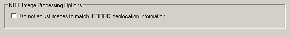
In some cases the geolocation information in the NITF file is either incorrect or it is not desirable to apply it to the image. By enabling the ‘Do not adjust image to match ICOORD geolocation information’ option the image will be processed as it is in the source data file (other than to apply any input or output coordinate systems), reordering the position of the corners to match the image. This was the the behaviour for MapLink 5.4 and earlier. This option may be applied at either the dataset level, where it will apply to each file in that dataset, or on an individual file basis within a dataset.
Links:
Copyright © 1998 to by Envitia Group PLC.