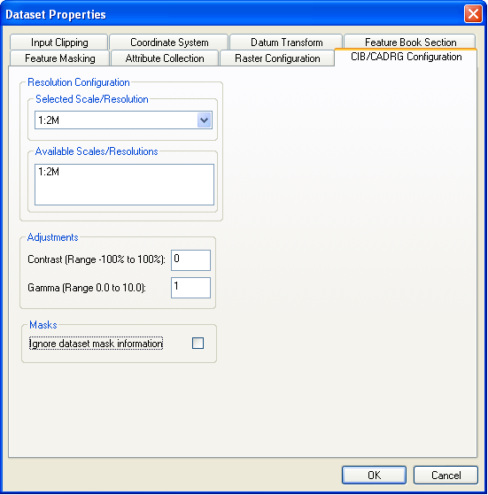
The Format Configuration panel is used to select which scale/resolution of data is being used.
Although CADRG has an input coordinate system, MapLink Pro Studio detects this and will automatically convert from the CADRG coordinates (in simple terms, lat/lon) to the required output coordinate system.
By default the CADRG/CIB filter will use the mask and transparency information from the frame files. This can be disabled by checking the box 'Ignore dataset mask information'. This may be required if the mask and transparent pixel information is incorrect (you will need to review the settings on the raster configuration panel as well if you select this option as the masks will not created from the data).
CADRG/CIB is an 8 bit colour depth format. When configuring the raster options the depth should be left as blank or set to 8. When projecting the data the options 'Maintain palette when projecting palettised images' and 'Disable dithering' should be selected as these options should ensure the quality of the map and reduce the disk space used.
Links:
Copyright © 1998 to by Envitia Group PLC.