The expectation is that the file always contains a tab delimited set of data in one of the following combinations. The appropriate format configuration settings are shown below:
The expectation is that the file always contains a tab delimited set of data in one of the following combinations. The appropriate format configuration settings are shown below:
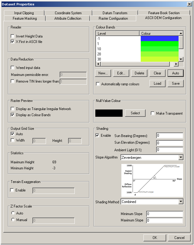
X Y Height (Options: Enable X First in ASCII File, Disable Invert Height Data)
X Y Depth (Options: Enable X First in ASCII File, Enable Invert Height Data)
Lat Lon Height (Options: Disable X First in ASCII File, Disable Invert Height Data)
Lon Lon Depth (Options: Disable X First in ASCII File, Enable Invert Height Data)
The data is analysed to build a Triangulated Irregular Network. This can be viewed by enabling the Display as Triangular Irregular Network option. If you are doing this it is best to disable the Raster Thumbnail View option in the MapLink Pro Studio Tools Menu as this will reduce the detail displayed.
The grid resolution is shown by the purple dots. With the Auto Output Grid Size option set MapLink Pro will compute the best grid spacing based on the data. However, you can override this and enter your own grid size in X and Y.
Alternatively you can display the data coloured and shaded based on height or depth using the options on the right of the panel. These controls are similar to DTED and DBDBV. The Make Transparent option will, as with DTED and DBDBV, create a mask preventing data points being drawn where no data exists.
For additional information see the following links:
Terrain Exaggeration
This control enables the terrain heights to be exaggerated by the factor entered.
Z Factor Scale
This control enables the grid units to be adjusted or scaled to so as to match the altitude units, e.g. scaling degrees to metres
Sometimes the TIN links are in a triangle that is too far apart to be sensibly interpolated. To avoid this, the maximum distance over which a triangle can be set is provided. This unit is a proportion of the entire width. For example, the value 0.1 would prevent a triangle with any side greater than 10% of the width of the Area Tinned being used in the generation of points. The TIN itself is not modified but the result can be seen in the colour shaded display.
Weeding allows the removal of points that are not contributing to the quality of the TIN, or are degrading it. If set it will remove points where there is clearly a conflict caused by rogue values. It is not generally necessary to set this.
It is sometimes necessary to correct for data in different scales or with different offsets. MapLink Pro assumes that data is generally referenced to a nominal vertical datum. In most cases the same datum as for DTED or DBDBV is used, and this is usually mean sea level. Height depth data is in therefore in metres.
There is an option in the Dataset Terrain Configuration page for terrain export to adjust both the offset and scale of specific data to take account of data with different datums or scales (e.g. in feet). Values for scale and offset will be applied to the data before it is fused into terrain. There is also the capability to set an input coordinate system, which converts point data from any coordinate system (for example, British National Grid, into WGS84 Lat/Lon, which is the MapLink core coordinate system.
Links:
Copyright © 1998 to by Envitia Group PLC.