DTED/DMED Configuration (Shaded Relief)
The DTED Configuration Panel allows the definition of the colours to be used with the DTED data. The panel is available at dataset or file level. Configuring the dataset allows the same colours to be applied to all of the data in the dataset.
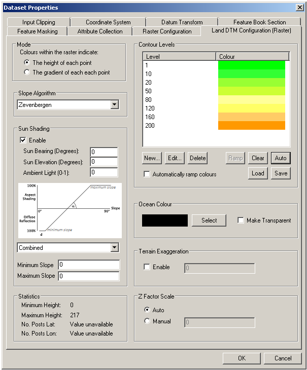
The panel is divided into 8 sections:
- Mode: This selects if the shading is based on height (in metres) or slope (gradient)
- Slope Algorithm: This selects which algorithm is used to calculate the slope between adjacent points.
- Sun Shading: This applies sunlight shading to the terrain when in height mode.
- Statistics: This gives minimum/maximum height to assist in setting levels. The grid spacing of the file (number of posts in x/y) is displayed as well.
- Contour Levels: This area defines a set of colour bands.
- Ocean Colour: This defines the colour or transparency of values below the lowest level.
- Terrain Exaggeration: This control enables the terrain heights to be exaggerated by the factor entered.
- Z Factor Scale: This control enables the grid units to be adjusted or scaled to so as to match the altitude units, e.g. scaling degrees to metres.
Note: Ocean Colour is only available if Legacy Slope and Legacy Shading is selected. Otherwise the ocean is coloured by the first contour in the list.
Ocean Colour
To define the colour of the ocean (elevation 0):
- Click the Select button.
- Select the colour in the colour dialog.
- Hit OK.
Copyright © 1998 to by Envitia Group PLC.