Passive component for displaying 2D data to a user supplied window.
The TSLDrawingSurface component is responsible for the display of 2D data in a window supplied by the end user. As the TSLDrawingSurface is passive, there are no inherent event handling routines.
This component provides the following capabilities
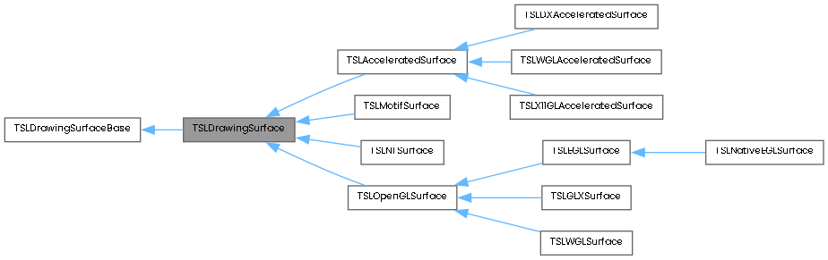
Other capabilities such as feature rendering, decluttering and style queries are provided by the base TSLDrawingSurfaceBase class and the derived platform specific classes.
A TSLDrawingSurface must be connected to a user-supplied window (or HDC/Pixmap) before it can display anything. It does not create a window of its own. This gives the user control over what is displayed in the window.
A TSLDrawingSurface will display 2D data from any data layers that are connected to it. Layer control is handled by the TSLDrawingSurfaceBase class.
The area of data displayed by the TSLDrawingSurface can be modified by the methods 'zoom' and 'pan'. These methods take user-unit parameters and attempt to maintain the aspect ratio of the view. To redraw a specific area on the TSLDrawingSurface, two 'draw...' methods are available. The user must inform the TSLDrawingSurface of any modifications to the window size (in pixels) using the method 'wndResize' so that the TSLDrawingSurface can correctly calculate the area to display in the window.
The user has an alternative method of changing the area displayed by the TSLDrawingSurface by calling 'resize'. This informs the TSLDrawingSurface of the complete world co-ordinate area to display. The image displayed by the drawing surface may be rotated by the 'rotate' method. This does not alter the raw data, only the way it is displayed on screen. Note that at present, Raster data cannot be rotated by MapLink.
Various methods are also available to set up user units, convert from internal TMC co-ordinate units to user units and vice versa. Line styles, fill styles, symbol styles, colors and fonts are loaded by the TSLDrawingSurface from a file by calling 'loadStandardConfig' or by individual calls to 'setupLineStyles', 'setupFillStyles', 'setupSymbols', 'setupColours' and 'setupFonts'. These methods are static should only be called once by the application. To free the memory associated with these configurations, the 'cleanup' static method should be called when an application finishes. References to single styles take the form of an index into the list of styles loaded.
TSLDrawingSurface provides mapping between 4 co-ordinate spaces:
This class is an abstract class, specifying the generic behaviour of a 2D TSLDrawingSurface.
Public Types | |
| enum | WrapAroundMode { WrapAroundDisabled , WrapAroundLongitudinal , WrapAroundDefault = WrapAroundDisabled } |
Public Member Functions | |
| bool | clearAllRendering () |
| bool | clearDynamicColours () |
| virtual TSLDrawingSurface * | clone (bool copyUserData=false)=0 |
| TSLRasterBuffer * | createRasterBuffer (unsigned int width, unsigned int height, TSLRasterBuffer::Format format, TSLRasterBuffer::FilterMode filterMode=TSLRasterBuffer::Linear) |
| bool | declutterIsVisible (const char *feature_name, double resolution=0.0, const char *layer_name=0) const |
| void | deleteSvgBufferData (char *buffer) const |
| bool | drawDU (TSLDeviceUnits x1, TSLDeviceUnits y1, TSLDeviceUnits x2, TSLDeviceUnits y2, bool clear, bool updateExtentOnly=false) |
| bool | drawUU (double x1, double y1, double x2, double y2, bool clear, bool updateExtentOnly=false) |
| bool | DUToLatLong (TSLDeviceUnits x, TSLDeviceUnits y, double *latitude, double *longitude, bool local=false, bool boundCheck=true) const |
| bool | DUToMU (TSLDeviceUnits x1, TSLDeviceUnits y1, double *x2, double *y2) const |
| bool | DUToTMC (TSLDeviceUnits x1, TSLDeviceUnits y1, TSLTMC *x2, TSLTMC *y2) const |
| bool | DUToUU (TSLDeviceUnits x1, TSLDeviceUnits y1, double *x2, double *y2) const |
| TSLEntity * | findEntityDU (TSLDeviceUnits x, TSLDeviceUnits y, TSLDeviceUnits aperture, int depth, const char *feature_name=NULL) |
| TSLEntity * | findEntityUU (double x, double y, double aperture, int depth, const char *feature_name=NULL) |
| TSLEntity * | findSelectedEntityDU (TSLDeviceUnits x, TSLDeviceUnits y, TSLDeviceUnits aperture, int depth=-1, bool ignoreMapDataLayers=false) |
| TSLEntity * | findSelectedEntityUU (double x, double y, double aperture, int depth=-1, bool ignoreMapDataLayers=false) |
| bool | getColourIndices (int **indices, int *num) |
| TSLDataLayer * | getCoordinateProvidingLayer () |
| const TSLDataLayer * | getCoordinateProvidingLayer () const |
| bool | getDeclutterRange (const char *featureName, double *innerLimit, double *outerLimit, const char *dataLayerName=0, const char *detailLayerName=0) |
| bool | getDeviceCapabilities (int &horizontalSizeMM, int &verticalSizeMM, int &horizontalSizePixels, int &verticalSizePixels) const |
| bool | getDeviceCapabilities (TSLDeviceCapabilities &capabilities) const |
| void | getDUExtent (TSLDeviceUnits *x1, TSLDeviceUnits *y1, TSLDeviceUnits *x2, TSLDeviceUnits *y2) const |
| bool | getFillStyleIndices (int **indices, int *num) |
| bool | getFontStyleIndices (int **indices, int *num) |
| bool | getLineStyleIndices (int **indices, int *num) |
| void | getMUExtent (double *x1, double *y1, double *x2, double *y2) const |
| bool | getSymbolStyleIndices (int **indices, int *num) |
| TSLDrawingSurfaceTiledBufferControl * | getTiledBufferController () |
| void | getTMCExtent (TSLEnvelope &extent) const |
| void | getUUExtent (double *x1, double *y1, double *x2, double *y2) const |
| bool | getViewedLatLongRange (double *latitude, double *longitude, double *range, bool local=false, bool boundCheck=true) const |
| bool | latLongToDU (double latitude, double longitude, TSLDeviceUnits *x, TSLDeviceUnits *y, bool local=false) const |
| bool | latLongToMU (double latitude, double longitude, double *x, double *y, bool local=false) const |
| bool | latLongToTMC (double latitude, double longitude, TSLTMC *x, TSLTMC *y, bool local=false) const |
| bool | latLongToUU (double latitude, double longitude, double *x, double *y, bool local=false) const |
| bool | MUToDU (double x1, double y1, TSLDeviceUnits *x2, TSLDeviceUnits *y2) const |
| bool | MUToLatLong (double x, double y, double *latitude, double *longitude, bool local=false, bool boundCheck=true) const |
| bool | MUToTMC (double x1, double y1, TSLTMC *x2, TSLTMC *y2) const |
| bool | MUToUU (double x1, double y1, double *x2, double *y2) const |
| bool | pan (double x1, double y1, bool auto_redraw=true) |
| bool | pan (double x1, double y1, TSLDeviceUnits xDU, TSLDeviceUnits yDU, bool auto_redraw=true) |
| TSLMapQuery * | query (const char *layerName, TSLTMC x1, TSLTMC y1, TSLTMC x2, TSLTMC y2, int depth=-1, const char *feature_name=NULL) const |
| TSLMapQuery * | query (const char *layerName, TSLTMC x1, TSLTMC y1, TSLTMC x2, TSLTMC y2, TSLSelector *selector) const |
| bool | redraw () |
| bool | reset (bool auto_redraw=true) |
| bool | resize (double x1, double y1, double x2, double y2, bool auto_redraw=true, bool keep_aspect=false) |
| bool | rotate (double angle) |
| double | rotation () const |
| bool | saveToSvg (const char *filePath, double svgPixelPerDU, TSLTMC bottomLeftX=TSL_LONG_MAX, TSLTMC bottomLeftY=TSL_LONG_MAX) |
| char * | saveToSvgBuffer (double svgPixelPerDU, TSLTMC bottomLeftX=TSL_LONG_MAX, TSLTMC bottomLeftY=TSL_LONG_MAX) |
| bool | setDeclutterRange (const char *featureName, double innerLimit, double outerLimit, const char *dataLayerName=0, const char *detailLayerName=0) |
| bool | setDeviceCapabilities (const int horizontalSizeMM=0, const int verticalSizeMM=0, const int horizontalSizePixels=0, const int verticalSizePixels=0) |
| bool | setDeviceCapabilities (const TSLDeviceCapabilities &capabilities) |
| void | setRedrawCallback (TSLDrawingSurfaceDrawCallback *callback) |
| bool | setupDynamicColours (const char *filename) |
| bool | setViewedLatLongRange (double latitude, double longitude, double range, bool local=false, bool auto_redraw=true, bool keep_aspect=false) |
| void | TMCperDU (double &xr, double &yr) |
| double | TMCperUU () |
| bool | TMCToDU (TSLTMC x1, TSLTMC y1, TSLDeviceUnits *x2, TSLDeviceUnits *y2) const |
| bool | TMCToLatLong (TSLTMC x, TSLTMC y, double *latitude, double *longitude, bool local=false, bool boundCheck=true) const |
| bool | TMCToMU (TSLTMC x1, TSLTMC y1, double *x2, double *y2) const |
| bool | TMCToUU (TSLTMC x1, TSLTMC y1, double *x2, double *y2) const |
| bool | updateEntityExtent (TSLEntity *entity, const char *layerName) |
| void | userUnitOrigin (double x_origin, double y_origin) |
| void | userUnitOrigin (TSLUUEnum origin_enum) |
| void | userUnits (double factor) |
| double | userUnits () |
| bool | UUToDU (double x1, double y1, TSLDeviceUnits *x2, TSLDeviceUnits *y2) const |
| bool | UUToLatLong (double x, double y, double *latitude, double *longitude, bool local=false, bool boundCheck=true) const |
| bool | UUToMU (double x1, double y1, double *x2, double *y2) const |
| bool | UUToTMC (double x1, double y1, TSLTMC *x2, TSLTMC *y2) const |
| void | wrapAroundMode (WrapAroundMode mode) |
| WrapAroundMode | wrapAroundMode () const |
| bool | wndResize (TSLDeviceUnits x1, TSLDeviceUnits y1, TSLDeviceUnits x2, TSLDeviceUnits y2, bool auto_redraw=true, TSLResizeActionEnum action=TSLResizeActionNone) |
| bool | zoom (double percent, bool zoom_in, bool auto_redraw=true) |
| TSLDrawingSurface () | |
| virtual | ~TSLDrawingSurface () |
| void | clearSymbolList () |
| void | clearFontList () |
| void | clearLineList () |
| void | clearFillList () |
| bool | removeFillStyle (TSLStyleID style) |
| bool | removeLineStyle (TSLStyleID style) |
| bool | removeSymbolStyle (TSLStyleID style) |
| bool | removeFontStyle (TSLStyleID style) |
| TSLStyleID | createFontID (const TSLSimpleString &name, TSLFontType meaningOfName, int fontWeight, bool italic=false, bool underline=false, bool antiAliased=false, const unsigned char *memoryBlock=NULL, TSLSize memoryBlockSize=0) |
| TSLStyleID | createStandardLineID (const unsigned char *pattern, TSLSize patternLength, int initialOffset, TSLLineScalingType scaleType) |
| TSLStyleID | createSymbolLineID (int symbolID, double size=0.0, TSLDimensionUnits sizeUnits=TSLDimensionUnitsUndefined, float rotation=0.0f, double anchorPointX=0.0, double anchorPointY=0.0, TSLDimensionUnits anchorPointUnits=TSLDimensionUnitsUndefined) |
| TSLStyleID | createStandardFillID (const unsigned char *pattern=NULL, TSLSize patternSizeInBytes=0, int patternXSize=0, int patternYSize=0) |
| TSLStyleID | createSymbolFillID (int symbolID, double size=0.0, TSLDimensionUnits sizeUnits=TSLDimensionUnitsUndefined, float rotation=0.0f, double anchorPointX=0.0, double anchorPointY=0.0, TSLDimensionUnits anchorPointUnits=TSLDimensionUnitsUndefined) |
| TSLStyleID | createSVGSymbolID (const TSLSimpleString &name, const unsigned char *memoryBlock=NULL, TSLSize memoryBlockSize=0) |
| TSLStyleID | createFontSymbolID (const TSLSimpleString &name, TSLFontType meaningOfName, const unsigned char *memoryBlock=NULL, TSLSize memoryBlockSize=0) |
| TSLStyleID | createRasterSymbolID (const TSLSimpleString &name, int xorigin, int yorigin, bool scaleable, const unsigned char *memoryBlock=NULL, TSLSize memoryBlockSize=0) |
| TSLStyleID | createSymbolIDFromSymbol (TSLStyleID symbolID, int numberofColourPairs, const int *colourFrom, const int *colourTo) |
| Public Member Functions inherited from TSLDrawingSurfaceBase | |
| bool | addDataLayer (TSLDataLayer *data_layer_interface, const char *data_id) |
| bool | addDynamicRenderer (TSLDynamicRenderer *renderer, TSLFeatureID featureID=-1, const char *layerName=0) |
| bool | addFeatureRendering (const char *featureName, TSLFeatureID featureID) |
| void | attach (TSLDeviceContext handle) |
| void | attach (TSLWindowHandle handle) |
| void | attach (TSLDrawableHandle handle) |
| bool | attach (void *pixelBuffer, int width, int height, size_t rowBytes=0) |
| bool | bringInFrontof (const char *move_data_layer, const char *target_data_layer) |
| bool | bringToFront (const char *move_data_layer) |
| bool | clearAllDeclutterData (const char *layer_name=0) |
| void | clearAllDynamicRenderers () |
| bool | clearBackgroundColour () |
| bool | clearDeclutterData (const char *feature_name, const char *layer_name=0) |
| bool | clearDynamicRenderer (TSLFeatureID featureID=-1, const char *layerName=0) |
| bool | clearFeatureRendering (const char *featureName, TSLFeatureID featureID) |
| bool | clearFrame () |
| bool | copyDeclutterData (const char *src_feature_name, const char *dest_feature_name, const char *src_layer_name=0, const char *dest_layer_name=0) |
| void | detach () |
| void | detachAllDynamicRenderers () |
| bool | detachDynamicRenderer (TSLFeatureID featureID=-1, const char *layerName=0) |
| const char * | featureClass (TSLFeatureID feature_id) |
| bool | forceLayer (const char *data_id, const char *detail_layer_name) |
| bool | getBackgroundColour (TSLStyleID *value) |
| bool | getColourValue (int colour, unsigned char &r, unsigned char &g, unsigned char &b) |
| TSLDataLayer * | getDataLayer (const char *data_id) |
| bool | getDataLayerInfo (int N, TSLDataLayer **dataLayer, const char **layerName) const |
| bool | getDataLayerProps (const char *data_id, TSLPropertyEnum property_id, TSLPropertyValue *old_value) |
| bool | getDeclutterStatus (const char *feature_name, TSLDeclutterStatusResultEnum *value, const char *dataLayerName=0, const char *detailLayerName=0) |
| bool | getDeclutterStatus (TSLFeatureID feature_id, TSLDeclutterStatusResultEnum *value, const char *dataLayerName, const char *detailLayerName=0) |
| TSLDynamicRenderer * | getDynamicRenderer (TSLFeatureID featureID=-1, const char *layerName=0) |
| bool | getFeatureRendering (const char *featureName, TSLFeatureID featureID, TSLRenderingAttributeInt attribute, int *result) const |
| bool | getFeatureRendering (const char *featureName, TSLFeatureID featureID, TSLRenderingAttributeDouble attribute, double *result) const |
| bool | getFeatureRendering (const char *featureName, TSLFeatureID featureID, TSLRenderingAttributeBool attribute, bool *result) const |
| bool | getFeatureRendering (const char *featureName, TSLFeatureID featureID, TSLRenderingAttributes *result) const |
| int | getNumDataLayers () const |
| bool | getOption (TSLOptionEnum option) |
| void | id (int id_) |
| int | id () const |
| bool | idleProcess () |
| bool | loadDeclutter (const char *filename) |
| bool | loadRendering (const char *filename) |
| TSLPickResultSet * | pick (TSLDeviceUnits x, TSLDeviceUnits y, TSLDeviceUnits aperture, int depth, TSLPickSelector *selector=0) |
| TSLPickResultSet * | pick (const char *data_id, TSLDeviceUnits x, TSLDeviceUnits y, TSLDeviceUnits aperture, int depth=-1, TSLPickSelector *selector=0) |
| bool | queryActiveLayer (const char *data_id, char *detail_layer_name, int detail_layer_name_size) |
| bool | removeDataLayer (const char *data_id) |
| bool | saveDeclutter (const char *filename, TSLMapLinkVersion ver=TSL_CURRENT_MAPLINK_VERSION) |
| bool | saveRendering (const char *filename, TSLMapLinkVersion ver=TSL_CURRENT_MAPLINK_VERSION) |
| bool | sendToBack (const char *move_data_layer) |
| bool | sendToBackOf (const char *move_data_layer, const char *target_data_layer) |
| bool | setBackgroundColour (int value) |
| bool | setCoordinateProvidingLayer (const char *layer_name) |
| bool | setDataLayerProps (const char *data_id, TSLPropertyEnum property_id, TSLPropertyValue new_value) |
| bool | setDeclutterStatus (const char *feature_name, TSLDeclutterStatusEnum value, const char *dataLayerName=0, const char *detailLayerName=0) |
| bool | setDeclutterStatus (TSLFeatureID feature_id, TSLDeclutterStatusEnum value, const char *dataLayerName=0, const char *detailLayerName=0) |
| bool | setDeclutterStatusOnAllFeatures (TSLDeclutterStatusEnum value, const char *dataLayerName=0, const char *detailLayerName=0) |
| bool | setFeatureRendering (const char *featureName, TSLFeatureID featureID, TSLRenderingAttributeInt attribute, int value) |
| bool | setFeatureRendering (const char *featureName, TSLFeatureID featureID, TSLRenderingAttributeDouble attribute, double value) |
| bool | setFeatureRendering (const char *featureName, TSLFeatureID featureID, TSLRenderingAttributeBool attribute, bool value) |
| bool | setFeatureRendering (const char *featureName, TSLFeatureID featureID, TSLRenderingAttributes *value) |
| bool | setFrame (int style, int colour, int thickness) |
| virtual void | setOption (TSLOptionEnum option, bool value) |
| double | TMCperMU () |
| TSLDrawingSurfaceTypeEnum | type () const |
| void | userWord (void *ptr) const |
| void * | userWord () const |
| bool | cloneDynamicRenderersFrom (const TSLDrawingSurfaceBase *otherSurface) |
| void | addDuplicateLayers (bool value) |
| virtual | ~TSLDrawingSurfaceBase () |
Static Public Member Functions | |
| static void | cleanup () |
| static bool | copy (TSLDrawingSurface *copyTo, TSLDrawingSurface *copyFrom, bool copyUserData=false) |
| static TSLStyleID | getIDOfNearestColour (int r, int g, int b) |
| static bool | loadStandardConfig (const char *path=0, bool delayLoadIncludes=false) |
| static bool | setupColours (const char *filename) |
| static bool | setupFillStyles (const char *filename, bool delayLoadIncludes=false) |
| static bool | setupFonts (const char *filename, bool delayLoadIncludes=false) |
| static bool | setupLineStyles (const char *filename, bool delayLoadIncludes=false) |
| static bool | setupSymbols (const char *filename, bool delayLoadIncludes=false) |
| static bool | setupSaveToSvg (const char *iniFilename) |
| static void | disableAntiAliasFonts () |
| static void | enableAntiAliasFonts () |
| Static Public Member Functions inherited from TSLDrawingSurfaceBase | |
| static bool | addLoader (TSLFileLoader *loader) |
| static bool | addPathList (TSLPathList *path_list) |
| static bool | findFile (const char *filename, TSLSimpleString &foundPath) |
| static TSLFileLoader * | getLoader () |
Additional Inherited Members | |
| Protected Member Functions inherited from TSLDrawingSurfaceBase | |
| TSLDrawingSurfaceBase () | |
| Protected Attributes inherited from TSLDrawingSurfaceBase | |
| void * | m_classID |
| TSLDrawingSurface::TSLDrawingSurface | ( | ) |
|
virtual |
|
static |
Free configuration settings.
This method should be called once before exiting the application which instanciates any number of TSLDrawingSurfaces. It will perform a full memory clean on all objects statically created by the application when setting it up, including any memory allocated during the setupFonts/Colours/Fillstyles/Linestyles/Symbols calls.
This method is designed to minimise the close down messages from Visual Studio which are in this case false positives.
| bool TSLDrawingSurface::clearAllRendering | ( | ) |
| bool TSLDrawingSurface::clearDynamicColours | ( | ) |
Clears the dynamic colour list.
Returns true on success, false otherwise.
| void TSLDrawingSurface::clearFillList | ( | ) |
Clear the dynamic fill list - Future Enhancement
| void TSLDrawingSurface::clearFontList | ( | ) |
Clear the dynamic font list - Future Enhancement
| void TSLDrawingSurface::clearLineList | ( | ) |
Clear the dynamic line list - Future Enhancement
| void TSLDrawingSurface::clearSymbolList | ( | ) |
Future Enhancements Do Not Use.
Clear the dynamic symbol list - Future Enhancement
|
pure virtual |
This method clones the drawing surface and creates another drawing surface which reference the same data layers, data layer properties, options and coordinate system configuration.
| copyUserData | If true, the userID and userWord will be copied to the new surface. |
Implemented in TSLDXAcceleratedSurface, TSLMotifSurface, TSLNTSurface, TSLOpenGLSurface, TSLSkiaSurface, TSLWGLAcceleratedSurface, and TSLX11GLAcceleratedSurface.
|
static |
Copies the contents of the drawing surface from 'copyFrom' to 'copyTo'.
The copy does not copy any HDC, HWND, Display* etc... settings.
The perceived purpose of this method is for printing surfaces which do not support printing.
The copy is not a deep copy as it takes references to the layers.
The copy does not copy any dynamic resources.
| copyTo | Drawing Surface to copy too. |
| copyFrom | Drawing Surface to copy from. |
| copyUserData | If true, the userID and userWord will be copied to the new surface. |
| TSLStyleID TSLDrawingSurface::createFontID | ( | const TSLSimpleString & | name, |
| TSLFontType | meaningOfName, | ||
| int | fontWeight, | ||
| bool | italic = false, | ||
| bool | underline = false, | ||
| bool | antiAliased = false, | ||
| const unsigned char * | memoryBlock = NULL, | ||
| TSLSize | memoryBlockSize = 0 ) |
Create a Font-style - Future Enhancement
| TSLStyleID TSLDrawingSurface::createFontSymbolID | ( | const TSLSimpleString & | name, |
| TSLFontType | meaningOfName, | ||
| const unsigned char * | memoryBlock = NULL, | ||
| TSLSize | memoryBlockSize = 0 ) |
Create a Symbol-style - Future Enhancement
| TSLRasterBuffer * TSLDrawingSurface::createRasterBuffer | ( | unsigned int | width, |
| unsigned int | height, | ||
| TSLRasterBuffer::Format | format, | ||
| TSLRasterBuffer::FilterMode | filterMode = TSLRasterBuffer::Linear ) |
Creates a new object that can be used to draw rasters to a MapLink drawing surface through the TSLRenderingInterface. For details on how to use the returned object refer to the class documentation for TSLRasterBuffer.
| width | The width in pixels of the raster to create. |
| height | The height in pixels of the raster to create. |
| format | The image format to use for the raster. |
| filterMode | The filtering mode to use when drawing the raster at a different resolution to the underlying image data. |
| TSLStyleID TSLDrawingSurface::createRasterSymbolID | ( | const TSLSimpleString & | name, |
| int | xorigin, | ||
| int | yorigin, | ||
| bool | scaleable, | ||
| const unsigned char * | memoryBlock = NULL, | ||
| TSLSize | memoryBlockSize = 0 ) |
Create a Symbol-style - Future Enhancement
| TSLStyleID TSLDrawingSurface::createStandardFillID | ( | const unsigned char * | pattern = NULL, |
| TSLSize | patternSizeInBytes = 0, | ||
| int | patternXSize = 0, | ||
| int | patternYSize = 0 ) |
Create a Fill-style - Future Enhancement
| TSLStyleID TSLDrawingSurface::createStandardLineID | ( | const unsigned char * | pattern, |
| TSLSize | patternLength, | ||
| int | initialOffset, | ||
| TSLLineScalingType | scaleType ) |
Create a Line-style - Future Enhancement
| TSLStyleID TSLDrawingSurface::createSVGSymbolID | ( | const TSLSimpleString & | name, |
| const unsigned char * | memoryBlock = NULL, | ||
| TSLSize | memoryBlockSize = 0 ) |
Create a Symbol-style - Future Enhancement - not implemented
| TSLStyleID TSLDrawingSurface::createSymbolFillID | ( | int | symbolID, |
| double | size = 0.0, | ||
| TSLDimensionUnits | sizeUnits = TSLDimensionUnitsUndefined, | ||
| float | rotation = 0.0f, | ||
| double | anchorPointX = 0.0, | ||
| double | anchorPointY = 0.0, | ||
| TSLDimensionUnits | anchorPointUnits = TSLDimensionUnitsUndefined ) |
Create a Fill-style - Future Enhancement - not implemented
| TSLStyleID TSLDrawingSurface::createSymbolIDFromSymbol | ( | TSLStyleID | symbolID, |
| int | numberofColourPairs, | ||
| const int * | colourFrom, | ||
| const int * | colourTo ) |
Create a Symbol-style - Future Enhancement - not implemented
| TSLStyleID TSLDrawingSurface::createSymbolLineID | ( | int | symbolID, |
| double | size = 0.0, | ||
| TSLDimensionUnits | sizeUnits = TSLDimensionUnitsUndefined, | ||
| float | rotation = 0.0f, | ||
| double | anchorPointX = 0.0, | ||
| double | anchorPointY = 0.0, | ||
| TSLDimensionUnits | anchorPointUnits = TSLDimensionUnitsUndefined ) |
Create a Line-style - Future Enhancement - not implemented
| bool TSLDrawingSurface::declutterIsVisible | ( | const char * | feature_name, |
| double | resolution = 0.0, | ||
| const char * | layer_name = 0 ) const |
Query for feature visibility at specified resolution on specified layer.
This method allows the user to query whether the feature defined by the input parameter feature_name, is visible at the resolution specified by the input parameter resolution.
| feature_name | Name of the feature being queried. |
| resolution | User units per device unit. 0.0 may be used to specify the current screen resolution. |
| layer_name | : The data layer to set the decluttering value for. If the name supplied does not match a loaded layer then this will fail, returning true. |
| void TSLDrawingSurface::deleteSvgBufferData | ( | char * | buffer | ) | const |
Delete the buffer returned by saveToSvgBuffer().
This method must be used to delete the buffer after a call to 'saveToSvgBuffer'. If this does not happen then memory will be leaked.
| buffer | Buffer to be deleted. |
|
static |
Disable anti-aliasing of fonts on the GDI drawing surface
Calling this method will disable font anti-aliasing in all instances of the TSLNTSurface This change will persist until the application terminates, or calls enableAntiAliasFonts().
| bool TSLDrawingSurface::drawDU | ( | TSLDeviceUnits | x1, |
| TSLDeviceUnits | y1, | ||
| TSLDeviceUnits | x2, | ||
| TSLDeviceUnits | y2, | ||
| bool | clear, | ||
| bool | updateExtentOnly = false ) |
Draw area of map onto drawing surface.
This method requests the TSLDrawingSurface to redraw the MapLink data within the area defined by the input co-ordinates. This method may be called whenever a part of the Drawing Surface has been exposed through some action.
Note, this method will only redraw the primitives if the view or decluttering have changed, or if any of the data layers have been notified as changed. If the drawing surface is double buffered, the attached TSLDataLayers are drawn into the double buffer and then the double buffer is written to the window handle. Any layer buffering is also taken into account.
If an individual TSLDatalayer is double buffered, and the user unit extent of the Drawing Surface has not changed, then the existing double buffer is copied to the attached window handle. If the user unit extent has changed, then the TSLDataLayer is drawn into the double buffer and then the double buffer is written to the window handle.
The updateExtentOnly flag is used to update only certain areas of the screen. Under some circumstances, such as a paint message from Windows, it is necessary to clip the area that is drawn to the window. However, if the window is partially obscured, then any double buffers will only be partially drawn and may thus contain invalid data. If you are certain that only the specified area needs updating then set this flag to true, otherwise set it to false.
| x1 | x value of bottom left co-ordinate (in device units) of the area to redraw. |
| y1 | y value of bottom left coordinate (in device units) of the area to redraw. |
| x2 | x value of top right co-ordinate (in device units) of the area to redraw. |
| y2 | y value of top right coordinate (in device units) of the area to redraw. |
| clear | If true this will clear the specified area before drawing any of the data. |
| updateExtentOnly | See drawUU. |
| bool TSLDrawingSurface::drawUU | ( | double | x1, |
| double | y1, | ||
| double | x2, | ||
| double | y2, | ||
| bool | clear, | ||
| bool | updateExtentOnly = false ) |
Draw area of map onto drawing surface.
This method requests the TSLDrawingSurface to redraw the MapLink data within the area defined by the input co-ordinates. This method may be called whenever a part of the Drawing Surface has been exposed through some action.
Note, this method will only redraw the primitives if the view or decluttering have changed, or if any of the data layers have been notified as changed. If the drawing surface is double buffered, the attached TSLDataLayers are drawn into the double buffer and then the double buffer is written to the window handle. Any layer buffering is also taken into account.
The updateExtentOnly flag is used to update only certain areas of the screen. Under some circumstances, such as a paint message from Windows, it is necessary to clip the area that is drawn to the window. However, if the window is partially obscured, then any double buffers will only be partially drawn and may thus contain invalid data. If you are certain that only the specified area needs updating then set this flag to true, otherwise set it to false.
| (x1,y1) | Bottom left co-ordinate (in user-units) of the area to redraw. |
| (x2,y2) | Top right co-ordinate (in user-units) of the area to redraw. |
| clear | If true this will clear the specified area before drawing any of the data. |
| updateExtentOnly | If true, then the updates to buffers and the window are clipped to the specified extent, otherwise only updates to the window are clipped. |
| bool TSLDrawingSurface::DUToLatLong | ( | TSLDeviceUnits | x, |
| TSLDeviceUnits | y, | ||
| double * | latitude, | ||
| double * | longitude, | ||
| bool | local = false, | ||
| bool | boundCheck = true ) const |
Convert from device co-ordinate to latitude/longitude co-ordinate.
This method uses the currently loaded transformations for the last TSLMapDataLayer that was added to the Drawing Surface. If this is invalid, then the method returns false.
| (x,y) | Device unit co-ordinate |
| (latitude,longitude) | Storage for lat/lon co-ordinate. |
| local | Indicates whether the lat/lon co-ordinate is in WGS84 or the local datum. |
| boundCheck | When the initial coordinates are outside of the map extent, the lat/lon returned could be invalid. When this flag is true, a check for invalid results is performed. This check will double the processing time required by the method, but return a validated status code. If the specified coordinate is guaranteed to be within the map extent, then this flag may be turned off. |
| bool TSLDrawingSurface::DUToMU | ( | TSLDeviceUnits | x1, |
| TSLDeviceUnits | y1, | ||
| double * | x2, | ||
| double * | y2 ) const |
Convert device unit co-ordinate to map units.
This method uses the currently loaded transformations for the last TSLMapDataLayer that was added to the Drawing Surface. If this is invalid, then the method returns false.
| (x1,y1) | Device unit co-ordinate |
| (x2,y2) | Storage for map unit co-ordinate. |
| bool TSLDrawingSurface::DUToTMC | ( | TSLDeviceUnits | x1, |
| TSLDeviceUnits | y1, | ||
| TSLTMC * | x2, | ||
| TSLTMC * | y2 ) const |
Convert device co-ordinate to internal co-ordinate.
This method uses the currently loaded transformations for the last TSLMapDataLayer that was added to the Drawing Surface. If this is invalid, then the method returns false.
| (x1,y1) | Device co-ordinate. |
| (x2,y2) | Storage for internal co-ordinate. |
| bool TSLDrawingSurface::DUToUU | ( | TSLDeviceUnits | x1, |
| TSLDeviceUnits | y1, | ||
| double * | x2, | ||
| double * | y2 ) const |
Convert from device co-ordinate to user unit co-ordinate.
This method uses the currently loaded transformations for the last TSLMapDataLayer that was added to the Drawing Surface. If this is invalid, then the method returns false.
| (x1,y1) | Device unit co-ordinate |
| (x2,y2) | Storage for user unit co-ordinate. |
|
static |
Enable anti-aliasing of fonts on the GDI drawing surface
Calling this method will enable font anti-aliasing in all instances of the TSLNTSurface This change will persist until the application terminates, or calls disableAntiAliasFonts().
| TSLEntity * TSLDrawingSurface::findEntityDU | ( | TSLDeviceUnits | x, |
| TSLDeviceUnits | y, | ||
| TSLDeviceUnits | aperture, | ||
| int | depth, | ||
| const char * | feature_name = NULL ) |
Find an entity at device unit position.
Note: For simple selection through a user interaction, see findSelectedEntityDU()
This method allows the user to retrieve an entity from any data layer attached to the drawing surface according to a location. The entity search can be refined by setting the last parameter in the argument list to a valid feature name. In this case an entity will be returned only if it belongs to the named feature. Only data layers which are visible and detectable will be searched. Only entities which are not decluttered on the drawing surface will be examined.
The TSLEntity returned is embedded within the tile so should not be destroyed by the user unless it is not required. Note that an entity deleted from a MapDataLayer tile may be reloaded when the tile is removed from the cache.
The search algorithm is as follows:
NOTE: When querying an Optimised map the query may return objects that can not be further analysed.
| x,y | Co-ordinate of the location where to find the entity on the map. These co-ordinates are in device units. |
| aperture | This specifies an extent around the location co-ordinate in which to search for the entity. This is in device units. |
| depth | Specifies how deep to look before returning a pointer to an object. If the depth is 0 it searches at the highest level in the model (that is it will return a Group rather than an entity within the Group). |
| feature_name | If not NULL, only entities of this feature name will be checked. |
| TSLEntity * TSLDrawingSurface::findEntityUU | ( | double | x, |
| double | y, | ||
| double | aperture, | ||
| int | depth, | ||
| const char * | feature_name = NULL ) |
Find an entity at user unit position.
This method allows the user to retrieve an entity from any data layer attached to the drawing surface according to a location. The entity search can be refined by setting the last parameter in the argument list to a valid feature name. In this case an entity will be returned only if it belongs to the named feature. Only data layers which are visible and detectable will be searched. Only entities which are not decluttered on the drawing surface will be examined.
The TSLEntity returned is embedded within the tile so should not be destroyed by the user unless it is not required. Note that an entity deleted from a MapDataLayer tile may be reloaded when the tile is removed from the cache.
The search algorithm is as follows :
NOTE: When querying an Optimised map the query may return objects that can not be further analysed.
| x,y | Co-ordinate of the location where to find the entity on the map. These co-ordinates are in user units. |
| aperture | This specifies an extent around the location co-ordinate in which to search for the entity. This is in user units. |
| depth | Specifies how deep to look before returning a pointer to an object. If the depth is 0 it searches at the highest level in the tile (that is it may return a Group rather than an entity within the Group). |
| feature_name | If not NULL, only entities of this feature name will be checked. |
| TSLEntity * TSLDrawingSurface::findSelectedEntityDU | ( | TSLDeviceUnits | x, |
| TSLDeviceUnits | y, | ||
| TSLDeviceUnits | aperture, | ||
| int | depth = -1, | ||
| bool | ignoreMapDataLayers = false ) |
Find an entity at device unit position.
This method allows the user to retrieve an entity from any data layer attached to the drawing surface according to a location. Only data layers which are visible and detectable will be searched. Only entities which are not decluttered on the drawing surface will be examined.
The TSLEntity returned may embedded within a map tile so should not be destroyed by the user unless it is not required. Note that an entity deleted from a MapDataLayer tile may be reloaded when the tile is removed from the cache.
The search algorithm is as follows:
NOTE: When querying an Optimised map the query may return objects that can not be further analysed.
| x,y | Co-ordinate of the location where to find the entity on the map. These co-ordinates are in device units. |
| aperture | This specifies an extent around the location co-ordinate in which to search for the entity. This is in device units. |
| depth | Specifies how deep to look before returning a pointer to an object. If the depth is -1 (the default), then all entities are searched regardless of depth. If the depth is 0 it searches at the highest level in the model (that is it will return a Group rather than an entity within the Group). |
| ignoreMapDataLayers | If true, then map data layers are ignored, even if detectable |
| TSLEntity * TSLDrawingSurface::findSelectedEntityUU | ( | double | x, |
| double | y, | ||
| double | aperture, | ||
| int | depth = -1, | ||
| bool | ignoreMapDataLayers = false ) |
Find an entity at user unit position.
This method allows the user to retrieve an entity from any data layer attached to the drawing surface according to a location. Only data layers which are visible and detectable will be searched. Only entities which are not decluttered on the drawing surface will be examined.
The TSLEntity returned may embedded within a map tile so should not be destroyed by the user unless it is not required. Note that an entity deleted from a MapDataLayer tile may be reloaded when the tile is removed from the cache.
The search algorithm is as follows:
NOTE: When querying an Optimised map the query may return objects that can not be further analysed.
| x,y | Co-ordinate of the location where to find the entity on the map. These co-ordinates are in user units. |
| aperture | This specifies an extent around the location co-ordinate in which to search for the entity. This is in user units. |
| depth | Specifies how deep to look before returning a pointer to an object. If the depth is -1 (the default), then all entities are searched regardless of depth. If the depth is 0 it searches at the highest level in the model (that is it will return a Group rather than an entity within the Group). |
| ignoreMapDataLayers | If true, then map data layers are ignored, even if detectable |
| bool TSLDrawingSurface::getColourIndices | ( | int ** | indices, |
| int * | num ) |
Query colour indices.
Queries colour indices specified in the colour file last loaded using setupColours. These indices may be be converted to OS specific handles using the colourValue method. Note that the indices are not necessarily contiguous.
| indices | Storage for pointer to indices. Populated if successful. The buffer is owned by the TSLDrawingSurface and should not be deleted. |
| num | Storage for number of indices in array. |
| TSLDataLayer * TSLDrawingSurface::getCoordinateProvidingLayer | ( | ) |
Returns the data layer that defines the coordinate system for the drawing surface. The coordinate system of this layer is used when performing coordinate conversions through the drawing surface (e.g. latLongToMU, MUToTMC).
The coordinate providing layer is normally the first data layer added to the drawing surface that has a TSLCoordinateSystem.
If no coordinate providing layer has been added to the drawing surface, this method returns NULL.
| const TSLDataLayer * TSLDrawingSurface::getCoordinateProvidingLayer | ( | ) | const |
Returns the data layer that defines the coordinate system for the drawing surface. The coordinate system of this layer is used when performing coordinate conversions through the drawing surface (e.g. latLongToMU, MUToTMC).
The coordinate providing layer is normally the first data layer added to the drawing surface that has a TSLCoordinateSystem.
If no coordinate providing layer has been added to the drawing surface, this method returns NULL.
| bool TSLDrawingSurface::getDeclutterRange | ( | const char * | featureName, |
| double * | innerLimit, | ||
| double * | outerLimit, | ||
| const char * | dataLayerName = 0, | ||
| const char * | detailLayerName = 0 ) |
Query automatic decluttering range.
This method retrieves the current visibility range for the named feature. This resolution range determines when a feature is visible. The resolution limits returned are valid only if the visibility status of this feature is set to automatic.
| featureName | Name of the feature. |
| innerLimit | Minimum resolution at which the feature type is visible (user units per device unit), i.e. maximum zoom in. |
| outerLimit | Maximum resolution at which the feature type is visible (user units per device unit), i.e. maximum zoom out. |
| dataLayerName | The name of the data layer to query. Defaults to 0 i.e. get for all layers. |
| detailLayerName | the name of the detail layer to query. Defaults to 0 to query all detail layers. |
| bool TSLDrawingSurface::getDeviceCapabilities | ( | int & | horizontalSizeMM, |
| int & | verticalSizeMM, | ||
| int & | horizontalSizePixels, | ||
| int & | verticalSizePixels ) const |
Returns the device capabilities as determined by the drawing surface, or as passed to setDeviceCapabilities. For more information on the meaning of these values refer to the documentation for setDeviceCapabilities.
| horizontalSizeMM | horizontal size of the visible screen in mm. |
| verticalSizeMM | vertical size of the visible screen in mm. |
| horizontalSizePixels | horizontal size of the screen in pixels. |
| verticalSizePixels | vertical size of the screen in pixels. |
| bool TSLDrawingSurface::getDeviceCapabilities | ( | TSLDeviceCapabilities & | capabilities | ) | const |
Returns the device capabilities as determined by the drawing surface, or as passed to setDeviceCapabilities. For more information on the meaning of these values refer to the documentation for setDeviceCapabilities.
| capabilities | Will be populated with the current device capabilities |
| void TSLDrawingSurface::getDUExtent | ( | TSLDeviceUnits * | x1, |
| TSLDeviceUnits * | y1, | ||
| TSLDeviceUnits * | x2, | ||
| TSLDeviceUnits * | y2 ) const |
Query extent of window.
This method allows the user to query the extent of the window handle currently displayed in terms of device units. This is the same extent that will have been passed in the last call to 'wndResize'.
| (x1,y1) | Storage for top left co-ordinate of the extent in device units. |
| (x2,y2) | Storage for bottom right co-ordinate of the extent in device units. |
| bool TSLDrawingSurface::getFillStyleIndices | ( | int ** | indices, |
| int * | num ) |
Query fill style indices.
Queries fill style indices specified in the fill style file last loaded using setupFillStyles. These indices may be be converted to OS specific handles using the fillStyleValue method. Note that the indices are not necessarily contiguous.
| indices | Storage for pointer to indices. Populated if successful. The buffer is owned by the TSLDrawingSurface and should not be deleted. |
| num | Storage for number of indices in array. |
| bool TSLDrawingSurface::getFontStyleIndices | ( | int ** | indices, |
| int * | num ) |
Query font style indices.
Queries font style indices specified in the font style file last loaded using setupFonts. These indices may be be converted to OS specific handles using the fontStyleValue method. Note that the indices are not necessarily contiguous.
| indices | Storage for pointer to indices. Populated if successful. The buffer is owned by the TSLDrawingSurface and should not be deleted. |
| num | Storage for number of indices in array. |
|
static |
Find the closest supported colour.
Finds the closest supported colour to the RGB value passed in.
| r | red value (0-255) |
| g | green value (0-255) |
| b | blue value (0-255) |
| bool TSLDrawingSurface::getLineStyleIndices | ( | int ** | indices, |
| int * | num ) |
Query line style indices.
Queries line style indices specified in the line style file last loaded using setupLineStyles. These indices may be be converted to OS specific handles using the lineStyleValue method. Note that the indices are not necessarily contiguous.
| indices | Storage for pointer to indices. Populated if successful. The buffer is owned by the TSLDrawingSurface and should not be deleted. |
| num | Storage for number of indices in array. |
| void TSLDrawingSurface::getMUExtent | ( | double * | x1, |
| double * | y1, | ||
| double * | x2, | ||
| double * | y2 ) const |
Query extent of data on TSLDrawingSurface.
This method allows the user to query the extent of the MapLink map data currently displayed in terms of map units.
Note: If the user application maintains such extent, this method should be called to refresh them after any operation applied on the TSLDrawingSurface which will affect the area of Maplink map data displayed.
| (x1,y1) | Storage for bottom left co-ordinate of the extent in map units. |
| (x2,y2) | Storage for top right co-ordinate of the extent in map units. |
| bool TSLDrawingSurface::getSymbolStyleIndices | ( | int ** | indices, |
| int * | num ) |
Query symbol style indices.
Queries symbol style indices specified in the symbol style file last loaded using setupSymbols. These indices may be be converted to OS specific handles using the symbolStyleValue method. Note that the indices are not necessarily contiguous.
| indices | Storage for pointer to indices. Populated if successful. The buffer is owned by the TSLDrawingSurface and should not be deleted. |
| num | Storage for number of indices in array. |
| TSLDrawingSurfaceTiledBufferControl * TSLDrawingSurface::getTiledBufferController | ( | ) |
Returns an object that an application can use to change settings for tiled buffered layers. Tiled buffered layers must first be enabled using the TSLOptionTileBufferedLayers drawing surface option.
See the class documentation for TSLDrawingSurfaceTiledBufferControl for more details.
| void TSLDrawingSurface::getTMCExtent | ( | TSLEnvelope & | extent | ) | const |
Query extent of data on TSLDrawingSurface.
This method allows the user to query the extent of the MapLink map data currently displayed in terms of TMC units.
Note: If the user application maintains such extent, this method should be called to refresh them after any operation applied on the TSLDrawingSurface which will affect the area of Maplink map data displayed.
| extent | Storage for the extent. |
| void TSLDrawingSurface::getUUExtent | ( | double * | x1, |
| double * | y1, | ||
| double * | x2, | ||
| double * | y2 ) const |
Query extent of data on TSLDrawingSurface.
This method allows the user to query the extent of the MapLink map data currently displayed in terms of user units, ignoring any rotation that has been applied to the drawing surface.
Note: If the user application maintains such extent, this method should be called to refresh them after any operation applied on the TSLDrawingSurface which will affect the area of Maplink map data displayed.
| (x1,y1) | Storage for bottom left co-ordinate of the extent in user units. |
| (x2,y2) | Storage for top right co-ordinate of the extent in user units. |
| bool TSLDrawingSurface::getViewedLatLongRange | ( | double * | latitude, |
| double * | longitude, | ||
| double * | range, | ||
| bool | local = false, | ||
| bool | boundCheck = true ) const |
Queries the extent of data currently in view. Returns the centre of the area in latitude and longitude in degrees, and the minimum range visible horizontally or vertically in map units. NOTE: This function is not appropriate for use when Dynamic Arc Support is enabled, since the X/Y aspect adjustment results in non-square TMC per DU values.
| latitude | returns the latitude of the centre of the currently viewed area, in degrees |
| longitude | returns the longitude of the centre of the currently viewed area, in degrees |
| range | returns the minimum visible distance horizontally or vertically, in map units |
| local | Indicates whether the lat/lon co-ordinate is in WGS84 or the local datum. |
| boundCheck | When the initial coordinates are outside of the map extent, the lat/lon returned could be invalid. When this flag is true, a check for invalid results is performed. This check will double the processing time required by the method, but return a validated status code. If the specified coordinate is guaranteed to be within the map extent, then this flag may be turned off. |
| bool TSLDrawingSurface::latLongToDU | ( | double | latitude, |
| double | longitude, | ||
| TSLDeviceUnits * | x, | ||
| TSLDeviceUnits * | y, | ||
| bool | local = false ) const |
Convert from latitude/longitude to device unit co-ordinate.
This operation will use the current Coordinate System to perform the conversion. This will usually be defined only for TSLMapDataLayers.
| (latitude,longitude) | Point to convert. |
| (x,y) | Storage for device unit co-ordinate. |
| local | Indicates whether the lat/lon co-ordinate is in WGS84 or the local datum. |
| bool TSLDrawingSurface::latLongToMU | ( | double | latitude, |
| double | longitude, | ||
| double * | x, | ||
| double * | y, | ||
| bool | local = false ) const |
Convert from latitude/longitude to Map Unit co-ordinate.
This operation will use the current Coordinate System to perform the conversion. This will usually be defined only for TSLMapDataLayers.
| (latitude,longitude) | Point to convert. |
| (x,y) | Storage for Map Unit co-ordinate. |
| local | Indicates whether the lat/lon co-ordinate is in WGS84 or the local datum. |
| bool TSLDrawingSurface::latLongToTMC | ( | double | latitude, |
| double | longitude, | ||
| TSLTMC * | x, | ||
| TSLTMC * | y, | ||
| bool | local = false ) const |
Convert from latitude/longitude to internal TMC co-ordinate.
This operation will use the current Coordinate System to perform the conversion. This will usually be defined only for TSLMapDataLayers.
| (latitude,longitude) | Point to convert. |
| (x,y) | Storage for internal TMC co-ordinate. |
| local | Indicates whether the lat/lon co-ordinate is in WGS84 or the local datum. |
| bool TSLDrawingSurface::latLongToUU | ( | double | latitude, |
| double | longitude, | ||
| double * | x, | ||
| double * | y, | ||
| bool | local = false ) const |
Convert from latitude/longitude to User Unit co-ordinate.
This operation will use the current Coordinate System to perform the conversion. This will usually be defined only for TSLMapDataLayers.
| (latitude,longitude) | Point to convert. |
| (x,y) | Storage for User Unit co-ordinate. |
| local | Indicates whether the lat/lon co-ordinate is in WGS84 or the local datum. |
|
static |
Loads the tsl*.dat files with the default names into all drawing surfaces. This is equivalent to firstly adding a pathlist configured to find data files, fonts, symbols and so on in the default subdirectories (e.g. addKeyedDirectory(root+"fonts", 0, ".thf", TSLCompressedDefault) ),
and secondly calling:
setupColours( "tslcolours.dat" );
setupFonts( "tslfonts.dat" );
setupSymbols( "tslsymbols.dat" );
setupLineStyles( "tsllinestyles.dat" );
setupFillStyles( "tslfillstyles.dat" );
| path | If supplied, this is the path from which the configuration files are to be loaded. If null, then the files are assumed to be present in the config subdirectory of the maplink installation on the local machine (whose location is found using TSLUtilityFunctions::getMapLinkHome()). Note that using a relative path here will cause problems if the working directory changes as the path will no longer point to the correct directory, so it is recommended to use an absolute path. |
| delayLoadIncludes | If this flag is set to true the all referenced include files in each of the configuration lists will only be loaded when they are required rather than during this call. This should not be set to true if rendering or querying any fillstyles, fonts, linestyles or symbols in a multithreaded environment. |
| bool TSLDrawingSurface::MUToDU | ( | double | x1, |
| double | y1, | ||
| TSLDeviceUnits * | x2, | ||
| TSLDeviceUnits * | y2 ) const |
Convert map unit co-ordinate to device units.
This method uses the currently loaded transformations for the last TSLMapDataLayer that was added to the Drawing Surface. If this is invalid, then the method returns false.
| (x1,y1) | Map unit co-ordinate |
| (x2,y2) | Storage for device unit co-ordinate. |
| bool TSLDrawingSurface::MUToLatLong | ( | double | x, |
| double | y, | ||
| double * | latitude, | ||
| double * | longitude, | ||
| bool | local = false, | ||
| bool | boundCheck = true ) const |
Convert map unit co-ordinate to latitude/longitudes.
This method uses the currently loaded transformations for the last TSLMapDataLayer that was added to the Drawing Surface. If this is invalid, then the method returns false.
| (x,y) | Map unit co-ordinate |
| (latitude,longitude) | Storage for lat/lon co-ordinate. |
| local | Indicates whether the lat/lon co-ordinate is in WGS84 or the local datum. |
| boundCheck | When the initial coordinates are outside of the map extent, the lat/lon returned could be invalid. When this flag is true, a check for invalid results is performed. This check will double the processing time required by the method, but return a validated status code. If the specified coordinate is guaranteed to be within the map extent, then this flag may be turned off. |
| bool TSLDrawingSurface::MUToTMC | ( | double | x1, |
| double | y1, | ||
| TSLTMC * | x2, | ||
| TSLTMC * | y2 ) const |
Convert map unit co-ordinate to internal units.
This method uses the currently loaded transformations for the last TSLMapDataLayer that was added to the Drawing Surface. If this is invalid, then the method returns false.
| (x1,y1) | Map unit co-ordinate |
| (x2,y2) | Storage for internal TMC unit co-ordinate. |
| bool TSLDrawingSurface::MUToUU | ( | double | x1, |
| double | y1, | ||
| double * | x2, | ||
| double * | y2 ) const |
Convert map unit co-ordinate to user units.
This method uses the currently loaded transformations for the last TSLMapDataLayer that was added to the Drawing Surface. If this is invalid, then the method returns false.
| (x1,y1) | Map unit co-ordinate |
| (x2,y2) | Storage for user unit co-ordinate. |
| bool TSLDrawingSurface::pan | ( | double | x1, |
| double | y1, | ||
| bool | auto_redraw = true ) |
Make specified point centre of display.
This method will cause the TSLDrawingSurface to pan so that the input co-ordinates are at the centre of the display area. If 'auto_redraw' it true, then the TSLDrawingSurface will automatically draw the new requested area on the window handle to which the TSLDrawingSurface is attached.
Note: The pan may cause the extent of the MapLink map data to overflow the extent of TMC coordinate space. In this case, the pan operation is not applied and the function returns false.
| (x1,y1) | Point co-ordinates (in user units) to be set at the centre of the display. |
| auto_redraw | If true, the TSLDrawingSurface redraws automatically. |
| bool TSLDrawingSurface::pan | ( | double | x1, |
| double | y1, | ||
| TSLDeviceUnits | xDU, | ||
| TSLDeviceUnits | yDU, | ||
| bool | auto_redraw = true ) |
Make specified point in UU space, move to specified point in DU space.
This method is typically used for grab-style panning. It is necessary since any Dynamic Arc adjustments may affect the device unit positioning of a normal pan.
This method will cause the TSLDrawingSurface to pan so that the input coordinates are at the specified point in the display area. If 'auto_redraw' is true, then the TSLDrawingSurface will automatically draw the new requested area on the window handle to which the TSLDrawingSurface is attached.
Note: The pan may cause the extent of the MapLink map data to overflow the extent of TMC coordinate space. In this case, the pan operation is not applied and the function returns false.
| (x1,y1) | Point coordinates (in user units) to be set at the specified point in the display area. |
| (xDU,yDU) | Point coordinates (in device units) for (x1,y1) to move to. |
| auto_redraw | If true, the TSLDrawingSurface redraws automatically. |
| TSLMapQuery * TSLDrawingSurface::query | ( | const char * | layerName, |
| TSLTMC | x1, | ||
| TSLTMC | y1, | ||
| TSLTMC | x2, | ||
| TSLTMC | y2, | ||
| int | depth = -1, | ||
| const char * | feature_name = NULL ) const |
Query for entities in extent.
The detail layer used is the layer for the current drawing surface extent.
This method requests the named layer to return a TSLMapQuery object which allows the user to access the data tiles required for the display of the specified area. The TSLMapQuery for a TSLDrawingSurface is only valid for immediate use since the data tiles to which they refer may be removed from memory if the cache is flushed.
In the default case, all tiles whose extent intersects the specified extent will be returned. These will include all entities within those tiles, even though some individual entities may not be within the extent.
Alternatively, if a depth is specified, then the query recurses into the tiles and returns only those individual entities that whose extents intersect the region. An optional feature name may also be specified.
NOTE: When querying an Optimised map the query may return objects that can not be further analysed.
| layerName | The name of the layer to query |
| (x1,y1) | The bottom left co-ordinate of the specified area (in internal TMC units) |
| (x2,y2) | the top right co-ordinate of the specified area (in internal TMC units) |
| depth | Specifies how deep to look before returning a pointer to an object. If the depth is -1 (the default), individual entities are returned. If the depth is 0 it searches at the highest level in the tile (that is it may return a Group rather than an entity within the Group). |
| feature_name | If not NULL, only entities of this feature name will be checked. |
| TSLMapQuery * TSLDrawingSurface::query | ( | const char * | layerName, |
| TSLTMC | x1, | ||
| TSLTMC | y1, | ||
| TSLTMC | x2, | ||
| TSLTMC | y2, | ||
| TSLSelector * | selector ) const |
Query for entities in extent based on a client-supplied search criteria.
The detail layer used is the layer for the current drawing surface extent.
This method requests the named layer to return a TSLMapQuery object which allows the user to access the data tiles required for the display of the specified area, or entities within those tiles. The TSLMapQuery for a TSLDrawingSurface is only valid for immediate use since the data tiles to which they refer may be removed from memory if the cache is flushed.
The client must specify the selection policy through a suitable TSLSelector-derived object.
NOTE: When querying an Optimised map the query may return objects that can not be further analysed.
| layerName | The name of the layer to query |
| (x1,y1) | The bottom left co-ordinate of the specified area (in internal TMC units) |
| (x2,y2) | the top right co-ordinate of the specified area (in internal TMC units) |
| selector | Specifies the selection criteria. See TSLSelector and TSLSelectorActionType for further details. |
| bool TSLDrawingSurface::redraw | ( | ) |
Clears and redraws the entire visible extent of the surface (as specified to wndResize).
| bool TSLDrawingSurface::removeFillStyle | ( | TSLStyleID | style | ) |
Remove a style from a Dynamic List - Future Enhancement
| bool TSLDrawingSurface::removeFontStyle | ( | TSLStyleID | style | ) |
Remove a style from a Dynamic List - Future Enhancement
| bool TSLDrawingSurface::removeLineStyle | ( | TSLStyleID | style | ) |
Remove a style from a Dynamic List - Future Enhancement
| bool TSLDrawingSurface::removeSymbolStyle | ( | TSLStyleID | style | ) |
Remove a style from a Dynamic List - Future Enhancement
| bool TSLDrawingSurface::reset | ( | bool | auto_redraw = true | ) |
Reset to full view.
This method resets the current UU extent so that the maximum extent of the attached TSLDataLayers is displayed in the attached window extent.
| auto_redraw | If true, automatically redraws the window. |
| bool TSLDrawingSurface::resize | ( | double | x1, |
| double | y1, | ||
| double | x2, | ||
| double | y2, | ||
| bool | auto_redraw = true, | ||
| bool | keep_aspect = false ) |
Changes displayed extent of map.
This method informs the TSLDrawingSurface of the map area that it is to be displayed. When the TSLDrawingSurface is first attached to the handle, it must be given the co-ordinates of the data area that it is to display.
Note: The resize may cause the extent of the MapLink map data to overflow the extent of TMC coordinate space. In this case, the resize operation is not applied and the function return false.
| (x1,y1) | Bottom left co-ordinate (in user-units) of the area to redraw. |
| (x2,y2) | Top right co-ordinate (in user-units) of the area to redraw. |
| auto_redraw | If true, will result in the whole drawing surface area being redrawn. Defaults to true. |
| keep_aspect | If true, will attempt to maintain the aspect ratio according to the current window aspect ratio. Defaults to false. |
| bool TSLDrawingSurface::rotate | ( | double | angle | ) |
Rotate the vector map display.
This method rotates the display of the MapLink map data. It does not affect the data in any way, only the display of the data. The data will rotate around the current extent centre.
Note: The rotation may cause the extent of the MapLink map data to overflow the internal TMC co-ordinate limits, in which case the rotation is not applied and the method returns false.
Note: If you need to rotate raster data, please consider using the TSLOpenGLSurface, or the Accelerator SDK. Samples exist for both of these approaches.
| angle | Angle of the rotation (in radians), +ve anti-clockwise from the +ve X axis. |
| double TSLDrawingSurface::rotation | ( | ) | const |
Queries the current rotation of the vector map display.
This method queries the current rotation the display of the MapLink map data.
Returns angle of the rotation (in radians), +ve anti-clockwise from the +ve X axis.
| bool TSLDrawingSurface::saveToSvg | ( | const char * | filePath, |
| double | svgPixelPerDU, | ||
| TSLTMC | bottomLeftX = TSL_LONG_MAX, | ||
| TSLTMC | bottomLeftY = TSL_LONG_MAX ) |
Convert geometry in all attached vector datalayers to SVG, and write to an XML file.
This uses values provided via setDeviceCapabilities() to get DU/TMC resolution.
Before calling this method, make sure to call setupSaveToSvg() 4 times during your application initialisation.
| filePath | The file to write the SVG data to. |
| svgPixelPerDU | The number of SVG pixels to use per MapLink device unit. 1.0 is a reasonable choice. |
| bottomLeftX | The TMC X co-ordinate to use as the bottom-left corner of the SVG. Default value is INT_MAX, which means use the leftmost edge of any attached layer (xMin() of getTMCExtent()). |
| bottomLeftY | The TMC Y co-ordinate to use as the bottom-left corner of the SVG. Default value is INT_MAX, which means use the bottommost edge of any attached layer (yMin() of getTMCExtent()). |
| char * TSLDrawingSurface::saveToSvgBuffer | ( | double | svgPixelPerDU, |
| TSLTMC | bottomLeftX = TSL_LONG_MAX, | ||
| TSLTMC | bottomLeftY = TSL_LONG_MAX ) |
Convert geometry in all attached vector datalayers to SVG, and write XML to a buffer. This buffer is a NUL-terminated string. Free it with deleteSvgBufferData() when finished.
This uses values provided via setDeviceCapabilities() to get DU/TMC resolution.
Before calling this method, make sure to call setupSaveToSvg() 4 times during your application initialisation.
| filePath | The file to write the SVG data to. |
| svgPixelPerDU | The number of SVG pixels to use per MapLink device unit. 1.0 is a reasonable choice. |
| bottomLeftX | The TMC X co-ordinate to use as the bottom-left corner of the SVG. Default value is INT_MAX, which means use the leftmost edge of any attached layer (xMin() of getTMCExtent()). |
| bottomLeftY | The TMC Y co-ordinate to use as the bottom-left corner of the SVG. Default value is INT_MAX, which means use the bottommost edge of any attached layer (yMin() of getTMCExtent()). |
| bool TSLDrawingSurface::setDeclutterRange | ( | const char * | featureName, |
| double | innerLimit, | ||
| double | outerLimit, | ||
| const char * | dataLayerName = 0, | ||
| const char * | detailLayerName = 0 ) |
Set automatic decluttering range.
This method sets the resolution range for which the named feature type is visible. This is only applicable when the visibility mode is TSLDeclutterStatusAuto. The range values are given as the number of user units per device unit.
The declutter status is set to TSLDeclutterStatusAuto after this method is called.
| featureName | Name of the feature type to set the visibility range for. |
| innerLimit | Minimum resolution at which the feature type is visible (user units per device unit), i.e. maximum zoom in. |
| outerLimit | Maximum resolution at which the feature type is visible (user units per device unit), i.e. maximum zoom out. |
| dataLayerName | The data layer to set the decluttering value for. Default is 0 i.e. set for all layers. |
| detailLayerName | the detail layer to set the cluttering value for. Default is 0 to set for all detail layers. |
| bool TSLDrawingSurface::setDeviceCapabilities | ( | const int | horizontalSizeMM = 0, |
| const int | verticalSizeMM = 0, | ||
| const int | horizontalSizePixels = 0, | ||
| const int | verticalSizePixels = 0 ) |
Set the device capabilities.
The set values are used when drawing items whose dimensions are defined as TSLDimensionUnitsPoints.
This method only needs to be called it the values need to be adjusted or reset to the default.
The set values will be discarded if attach is called.
The settings will not be used when a call is made to drawToHDC or drawToDrawable. The user will need to pass in the device capabilities to these methods (defaults for the device will be used otherwise).
Default values are obtained from the underlying drawing system.
On Windows the values can be obtained using the Windows SDK method: GetDeviceCaps.
On X11 targets the values can be obtained using the macros found in Xlib.h: DisplayWidthMM, DIsplayHeightMM, DisplayWidth, DisplayHeight.
If the parameters are all set to zero the method queries the System defaults and sets those values.
| horizontalSizeMM | horizontal size of the visible screen in mm's. |
| verticalSizeMM | vertical size of the visible screen in mm's. |
| horizontalSizePixels | horizontal size of the screen in pixels. |
| verticalSizePixels | vertical size of the screen in pixels. |
See Also: TSLNTSurface::drawToHDC, TSLMotifSurface::drawToDrawable
| bool TSLDrawingSurface::setDeviceCapabilities | ( | const TSLDeviceCapabilities & | capabilities | ) |
Set the device capabilities.
The set values are used when drawing items whose dimensions are defined as TSLDimensionUnitsPoints.
This method only needs to be called it the values need to be adjusted or reset to the default.
The set values will be discarded if attach is called.
The settings will not be used when a call is made to drawToHDC or drawToDrawable. The user will need to pass in the device capabilities to these methods (defaults for the device will be used otherwise).
Default values are obtained from the underlying drawing system.
On Windows the values can be obtained using the Windows SDK method: GetDeviceCaps.
On X11 targets the values can be obtained using the macros found in Xlib.h: DisplayWidthMM, DIsplayHeightMM, DisplayWidth, DisplayHeight.
If the parameters are all set to zero the method queries the System defaults and sets those values.
| capabilities | The capabilities of the device. |
See Also: TSLNTSurface::drawToHDC, TSLMotifSurface::drawToDrawable
| void TSLDrawingSurface::setRedrawCallback | ( | TSLDrawingSurfaceDrawCallback * | callback | ) |
Sets the callback object to use when the drawing surface needs to trigger a redraw. This is currently used by tiled buffered layers.
The user retains ownership of the callback object.
| callback | The callback object to use. Passing NULL clears any existing callback. |
|
static |
Load colour definition file.
This method allows the user to set up a list of colours that will be used by all TSLDrawingSurfaces.
If addPathList or loadStandardConfig has been called then the pathlist is used to search for the file in suitable directories (using keying), if not then the system Path and the environment variable MAPLINK_PATH are used to search for the file, or alternatively the filename may be fully qualified.
| filename | Name of the colour file. |
| bool TSLDrawingSurface::setupDynamicColours | ( | const char * | filename | ) |
Load colour definition file into the surface dynamic colour list.
This method allows the user to set up a list of colours which are used only by this instance of the Drawing Surface.
The current dynamic colours are not cleared. The colours loaded will overwrite any colour index that already exist.
If addPathList or loadStandardConfig has been called then the pathlist is used to search for the file in suitable directories (using keying), if not then the system Path and the environment variable MAPLINK_PATH are used to search for the file, or alternatively the filename may be fully qualified.
| filename | Name of the colour file. |
|
static |
Load fill style definition file.
This method allows the user to set up the list of fill styles that will be used by all TSLDrawingSurfaces.
If addPathList or loadStandardConfig has been called then the pathlist is used to search for the file in suitable directories (using keying), if not then the system Path and the environment variable MAPLINK_PATH are used to search for the file, or alternatively the filename may be fully qualified.
| filename | Name of the fill style file. |
| delayLoadIncludes | If this flag is set to true the all referenced include files in the fillstyle list will only be loaded when they are required rather than during this call. This should not be set to true if rendering or querying fillstyles in a multithreaded environment. |
|
static |
Load font definition file.
This method allows the user to set up the list of fonts that will be used by all TSLDrawingSurface when rendering text.
If addPathList or loadStandardConfig has been called then the pathlist is used to search for the file in suitable directories (using keying), if not then the system Path and the environment variable MAPLINK_PATH are used to search for the file, or alternatively the filename may be fully qualified.
| filename | Name of the font file. |
| delayLoadIncludes | If this flag is set to true the all referenced include files in the font list will only be loaded when they are required rather than during this call. This should not be set to true if rendering or querying fonts in a multithreaded environment. |
|
static |
Load line style definition file.
This method allows the user to set up the list of line styles that will be used by all TSLDrawingSurfaces.
If addPathList or loadStandardConfig has been called then the pathlist is used to search for the file in suitable directories (using keying), if not then the system Path and the environment variable MAPLINK_PATH are used to search for the file, or alternatively the filename may be fully qualified.
| filename | Name of the line style file. |
| delayLoadIncludes | If this flag is set to true the all referenced include files in the linestyle list will only be loaded when they are required rather than during this call. This should not be set to true if rendering or querying linestyles in a multithreaded environment. |
|
static |
Load a SVG style definition INI file.
There are 4 separate INI files that all need to be loaded in order to make the methods TSLDrawingSurface::saveToSvg(), TSLDrawingSurface::saveToSvgBuffer(), TSLStandardDataLayer::saveToSvg() and TSLStandardDataLayer::saveToSvgBuffer() work properly.
The 4 INI files – which can be loaded in any order – are:
If addPathList() or loadStandardConfig() has been called then the pathlist is used to search for the file in suitable directories (using keying), if not then the system Path and the environment variable MAPLINK_PATH are used to search for the file, or alternatively the filename may be fully qualified.
| iniFilename | Filename of the INI file, possibly with a relative or absolute path. |
|
static |
Load symbol definition file.
This method allows the user to set up the list of symbols that will be used by all TSLDrawingSurfaces.
If addPathList or loadStandardConfig has been called then the pathlist is used to search for the file in suitable directories (using keying), if not then the system Path and the environment variable MAPLINK_PATH are used to search for the file, or alternatively the filename may be fully qualified.
| filename | Name of the symbol file. |
| delayLoadIncludes | If this flag is set to true the all referenced include files in the symbol list will only be loaded when they are required rather than during this call. This should not be set to true if rendering or querying symbols in a multithreaded environment. |
| bool TSLDrawingSurface::setViewedLatLongRange | ( | double | latitude, |
| double | longitude, | ||
| double | range, | ||
| bool | local = false, | ||
| bool | auto_redraw = true, | ||
| bool | keep_aspect = false ) |
Sets the extent of data to view. Takes the centre of the area in latitude and longitude in degrees, and the minimum range to make visible horizontally or vertically in map units. NOTE: This function is not appropriate for use when Dynamic Arc Support is enabled, since the X/Y aspect adjustment results in non-square TMC per DU values.
| latitude | the latitude to place at the centre of the viewed area, in degrees |
| longitude | the longitude to place at the centre of the viewed area, in degrees |
| range | the minimum distance to make visible horizontally or vertically, in map units |
| local | Indicates whether the lat/lon co-ordinate is in WGS84 or the local datum. |
| auto_redraw | If true, will result in the whole drawing surface area being redrawn. |
| keep_aspect | If true, will attempt to maintain the aspect ratio according to the current window aspect ratio. If false, the aspect ratio will be changed to meet the given range in both directions. |
| void TSLDrawingSurface::TMCperDU | ( | double & | xr, |
| double & | yr ) |
Query current screen resolution, varying in X and Y axis. These are usually the same, but may differ - e.g. Dynamic Arc projections.
This method gives the current resolution of the screen. This value is in internal TMC co-ordinates per device unit (pixel).
| xr | Storage for X axis resolution |
| yr | Storage for Y axis resolution |
| double TSLDrawingSurface::TMCperUU | ( | ) |
Query number of TMC units per user unit.
This value is the number of internal TMC co-ordinates per user unit. These is based upon the last map data layer added to the drawing surface.
Returns the TMC units per user unit, 0.0 on error.
| bool TSLDrawingSurface::TMCToDU | ( | TSLTMC | x1, |
| TSLTMC | y1, | ||
| TSLDeviceUnits * | x2, | ||
| TSLDeviceUnits * | y2 ) const |
Converts internal co-ordinate to device co-ordinate.
This method uses the currently loaded transformations for the last TSLMapDataLayer that was added to the Drawing Surface. If this is invalid, then the method returns false.
| (x1,y1) | Internal co-ordinate |
| (x2,y2) | Storage for device co-ordinate . |
| bool TSLDrawingSurface::TMCToLatLong | ( | TSLTMC | x, |
| TSLTMC | y, | ||
| double * | latitude, | ||
| double * | longitude, | ||
| bool | local = false, | ||
| bool | boundCheck = true ) const |
Convert from internal TMC co-ordinate to latitude/longitude.
This method uses the currently loaded transformations for the last TSLMapDataLayer that was added to the Drawing Surface. If this is invalid, then the method returns false.
| (x,y) | Internal TMC co-ordinate. |
| (latitude,longitude) | Storage for lat/lon co-ordinate. |
| local | Indicates whether the lat/lon co-ordinate is in WGS84 or the local datum. |
| boundCheck | When the initial coordinates are outside of the map extent, the lat/lon returned could be invalid. When this flag is true, a check for invalid results is performed. This check will double the processing time required by the method, but return a validated status code. If the specified coordinate is guaranteed to be within the map extent, then this flag may be turned off. |
| bool TSLDrawingSurface::TMCToMU | ( | TSLTMC | x1, |
| TSLTMC | y1, | ||
| double * | x2, | ||
| double * | y2 ) const |
Converts from internal co-ordinate to user unit co-ordinate.
This method uses the currently loaded transformations for the last TSLMapDataLayer that was added to the Drawing Surface. If this is invalid, then the method returns false.
| x1 | X TMC co-ordinate |
| y1 | Y TMC co-ordinate |
| x2 | Storage for X map unit co-ordinate. |
| y2 | Storage for Y map unit co-ordinate. |
| bool TSLDrawingSurface::TMCToUU | ( | TSLTMC | x1, |
| TSLTMC | y1, | ||
| double * | x2, | ||
| double * | y2 ) const |
Converts from internal co-ordinate to user unit co-ordinate.
This method uses the currently loaded transformations for the last TSLMapDataLayer that was added to the Drawing Surface. If this is invalid, then the method returns false.
| (x1,y1) | Internal co-ordinate |
| (x2,y2) | Storage for user unit co-ordinate. |
| bool TSLDrawingSurface::updateEntityExtent | ( | TSLEntity * | entity, |
| const char * | layerName ) |
Recalculates last rendered extent of a point on the drawingsurface using the currently loaded rendition, without actually rendering it.
After changing attributes of some objects, such as symbol style and text font, their extent may change. Since the extent of text and some symbol objects can only be know at rendering time (due to raster fonts etc), their extent may need to be updated by performing a dummy render. This is also necessary after a text objects string has been changed. This is only necessary for text and symbol entities.
If the entity was retrieved from a data layer (e.g. a TSLMapDataLayer), then the name given to the layer when it was added to this drawing surface should be specified in order to ensure the extent is updated correctly.
| entity | Entity whose extent to update. |
| layerName | The name of the data layer in this drawing surface that contains the entity. |
| void TSLDrawingSurface::userUnitOrigin | ( | double | x_origin, |
| double | y_origin ) |
Set origin of user unit coordinate system.
This method defines the position of the user units origin in the map output co-ordinate space.
| (x_origin,y_origin) | Co-ordinate of the user units origin in map units. |
| void TSLDrawingSurface::userUnitOrigin | ( | TSLUUEnum | origin_enum | ) |
Defines the position of the user units origin.
This method allows the origin to be set to some typical standard values which are calculated according to the current map loaded.
| origin_enum | Point in the map to be set for the user unit origin. The value can be:
|
| double TSLDrawingSurface::userUnits | ( | ) |
Query number of map units per user unit.
This method returns the number of map units equating to the a single user unit.
| void TSLDrawingSurface::userUnits | ( | double | factor | ) |
Set number of map units per user unit.
This method allows the user to inform the TSLDrawingSurface of how many map units equate to a single user unit. Co-ordinate information sent to the TSLDrawingSurface is normally in user units.
This method should be called at the initialisation phase of your application.
| factor | Number of map output co-ordinates for a single user unit. |
| bool TSLDrawingSurface::UUToDU | ( | double | x1, |
| double | y1, | ||
| TSLDeviceUnits * | x2, | ||
| TSLDeviceUnits * | y2 ) const |
Convert from user co-ordinate to device co-ordinate.
This method uses the currently loaded transformations for the last TSLMapDataLayer that was added to the Drawing Surface. If this is invalid, then the method returns false.
| (x1,y1) | User unit co-ordinate |
| (x2,y2) | Storage for device co-ordinate. |
| bool TSLDrawingSurface::UUToLatLong | ( | double | x, |
| double | y, | ||
| double * | latitude, | ||
| double * | longitude, | ||
| bool | local = false, | ||
| bool | boundCheck = true ) const |
Convert user unit co-ordinate to latitude/longitude
This method uses the currently loaded transformations for the last TSLMapDataLayer that was added to the Drawing Surface. If this is invalid, then the method returns false.
| (x,y) | User unit co-ordinate |
| (latitude,longitude) | Storage for lat/lon co-ordinate. |
| local | Indicates whether the lat/lon co-ordinate is in WGS84 or the local datum. |
| boundCheck | When the initial coordinates are outside of the map extent, the lat/lon returned could be invalid. When this flag is true, a check for invalid results is performed. This check will double the processing time required by the method, but return a validated status code. If the specified coordinate is guaranteed to be within the map extent, then this flag may be turned off. |
| bool TSLDrawingSurface::UUToMU | ( | double | x1, |
| double | y1, | ||
| double * | x2, | ||
| double * | y2 ) const |
Convert user unit co-ordinate to map units.
This method uses the currently loaded transformations for the last TSLMapDataLayer that was added to the Drawing Surface. If this is invalid, then the method returns false.
| (x1,y1) | User unit co-ordinate |
| (x2,y2) | Storage for map unit co-ordinate. |
| bool TSLDrawingSurface::UUToTMC | ( | double | x1, |
| double | y1, | ||
| TSLTMC * | x2, | ||
| TSLTMC * | y2 ) const |
Convert from user unit co-ordinate to an internal co-ordinate.
This method uses the currently loaded transformations for the last TSLMapDataLayer that was added to the Drawing Surface. If this is invalid, then the method returns false.
| (x1,y1) | User unit co-ordinate. |
| (x2,y2) | Storage for internal co-ordinate. |
| bool TSLDrawingSurface::wndResize | ( | TSLDeviceUnits | x1, |
| TSLDeviceUnits | y1, | ||
| TSLDeviceUnits | x2, | ||
| TSLDeviceUnits | y2, | ||
| bool | auto_redraw = true, | ||
| TSLResizeActionEnum | action = TSLResizeActionNone ) |
The user application should call this function on a window resize.
This methods informs the TSLDrawingSurface of a change in size of the attached window handle. If the handle is resized and the TSLDrawingSurface is not informed then the displayed area will remain the same though it may be clipped if the attached handle is reduced in size. All input co-ordinates are given in device units; this is typically in pixels.
Optionally, the uuExtent may be adjusted to fit the new window size. The action parameter determines what should happen to the uuExtent. This is the recommended way to handle this situation since the user unit extent and window extent are not independent.
Note: when the Drawing Surface is first attached to a handle it must be given the co-ordinates of the area that it is to display. This is not necessarily the full area of the handle.
| (x1,y1) | Top left co-ordinate (in device units) of the area to draw. For the OpenGL surface 0,0 is the bottom left corner, y positive upwards. For all other drawing surfaces 0,0 is the top-left corner, y positive downwards. |
| (x2,y2) | Bottom right co-ordinate (in device units) of the area to draw. For the OpenGL surface 0,0 is the bottom left corner, y positive upwards. For all other drawing surfaces 0,0 is the top-left corner, y positive downwards. |
| auto_redraw | If true, will result in the whole drawing surface area being redrawn. |
| action | One of TSLResizeActionEnum values. Determines if the uuExtent is adjusted automatically. Typically, this is set to TSLResizeActionMaintainTopLeft. The default value, for compatibility is TSLResizeActionNone. A map using the Dynamic Arc coordinate system, with the TSLOptionAdjustForDynamicArc option set on the Drawing Surface, causes the action argument to behave differently than for other configurations:
|
| WrapAroundMode TSLDrawingSurface::wrapAroundMode | ( | ) | const |
Get the current wrap-around mode.
| void TSLDrawingSurface::wrapAroundMode | ( | WrapAroundMode | mode | ) |
New in MapLink Pro 11.2.1.
Set the wrap-around mode. Options are disabled or longitudinal wrapping. Longitudinal wrapping will cause the map display to continue across the dateline in both easterly and westerly directions. The wrap-around option will be applied on the next draw. If wrap-around mode is enabled and your application implements a TSLClientCustomDataLayer, you will need to override the new drawLayer(TSLRenderingInterface* , const TSLEnvelope* , const TSLEnvelope* , TSLCustomDataLayerHandler& ) virtual method to find the features to draw when drawing a wrap tile.
| bool TSLDrawingSurface::zoom | ( | double | percent, |
| bool | zoom_in, | ||
| bool | auto_redraw = true ) |
Zoom current view in or out.
This method will cause the TSLDrawingSurface to zoom based on the percentage value 'percent'. If 'auto_redraw' it true, then the TSLDrawingSurface will automatically draw the new requested area on the window handle to which the TSLDrawingSurface is attached.
Note: The zoom may cause the extent of the MapLink map data to overflow the extent of TMC coordinate space. In this case, the zoom operation is not applied and the function returns false.
| percent | The factor given is a percentage of the current amount of map displayed. Any value greater than 0 is valid. |
| zoom_in | The method will apply a zoom in if this argument is equal to true, or a zoom out if it is equal to false. |
| auto_redraw | If true, the TSLDrawingSurface redraws automatically. |
